The Sun Gate

Casa Ollanta, Ollantaytambo. 20.15.

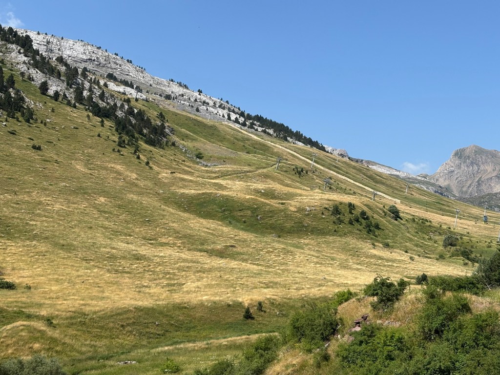
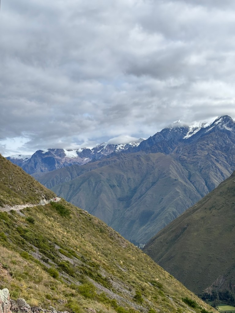
Today’s mission: Inti Punku, one of a number of “sun gates” scattered throughout the Sacred Valley. Situated atop a clouded mountain spur of snowbound Huayanay at around 3.830m above sea level, it is a formidable hike from Ollantaytambo, requiring a climb of over a thousand metres.

Since I had no intention of hiking the Inca trail to the gringo hotspot of Machu Picchu, the Inti Punku of Ollantaytambo was always the end goal of this adventure – the great hike at the end of my labours. I was told by a guide the other day that, provided I was young and fit, it would be no problem whatsoever.

Young is never going to be a problem. Fitness, however, is an interesting concept. I wouldn’t exactly describe myself as unfit, but I also would freely admit that I don’t exactly do a lot of exercise – beyond running about all over the place like a bumblebee at work. So the Inti Punku would be my test in more ways than one.


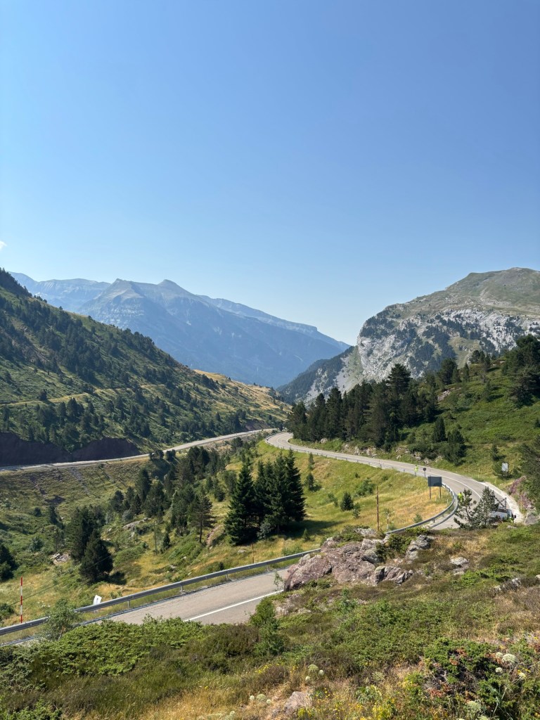
I set out early, but not too early. Too early for breakfast at the hotel, but not so early that the road was dark. I was lucky with the weather today: while the sun came and went throughout the morning, I was shielded from its high altitude fury by a merciful cover of cloud for most of the ascent. It rained on my descent, true, but not in the same way I experienced in the rainforest – more of a constant light shower, which was actually quite refreshing.

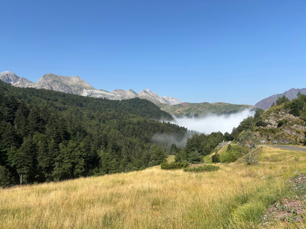
All the way up to the Sun Gate, I climbed in the shadow of Wakaywillque, more commonly known as Nevado Verónica, the largest of the mountains in the Sacred Valley.


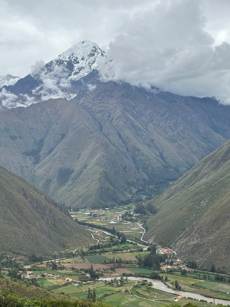
It’s not yet winter here in Peru, but the snows of Wakaywillque are here all year round. Glaciers cling to its peak like frozen tears – an apt description, as its Quechua name literally means “sacred tear”. It was so named, or so the story goes, after Manco Inca’s flight over the Abra Malaga pass, signalling the end of the reign of the Inca in Peru.

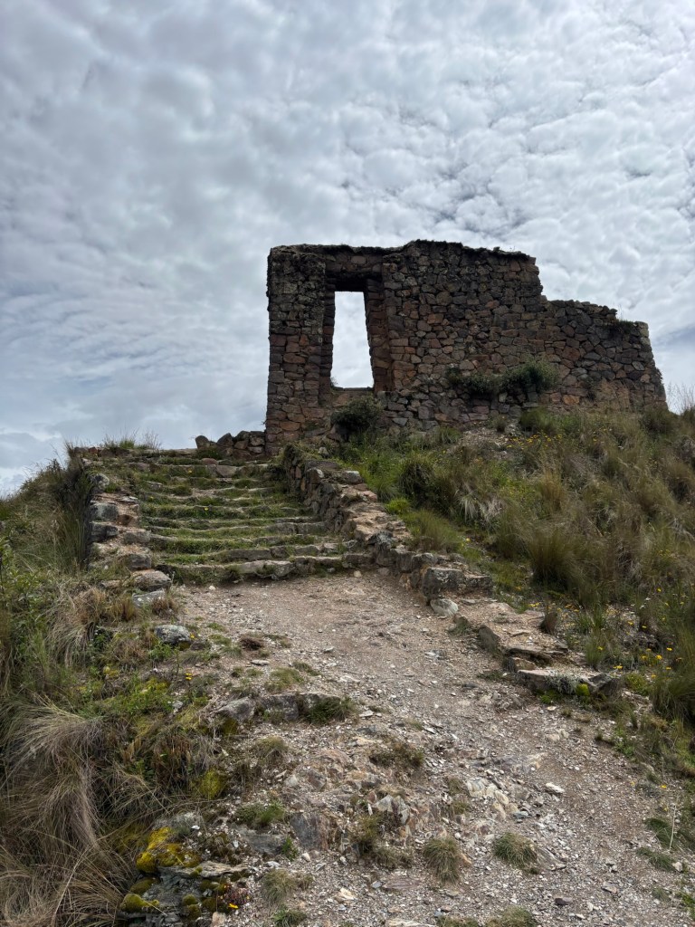
The empty frame of the Inti Punku looks out directly onto the mountain. The Inca sun gates were built with the summer solstice in mind, framing the Sun at its zenith on the right day of the year. But I can’t help but feel the fact that this one faces the mighty apu of Wakaywillque was an intentional decision on the part of its architects. It truly is a spectacular mountain.


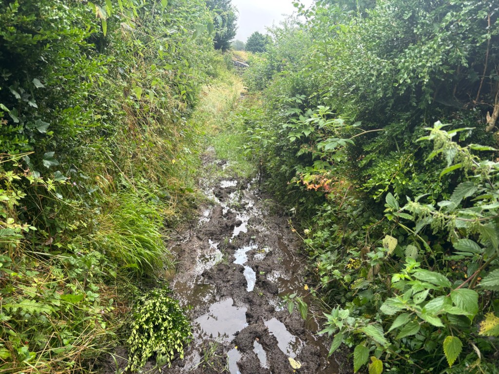
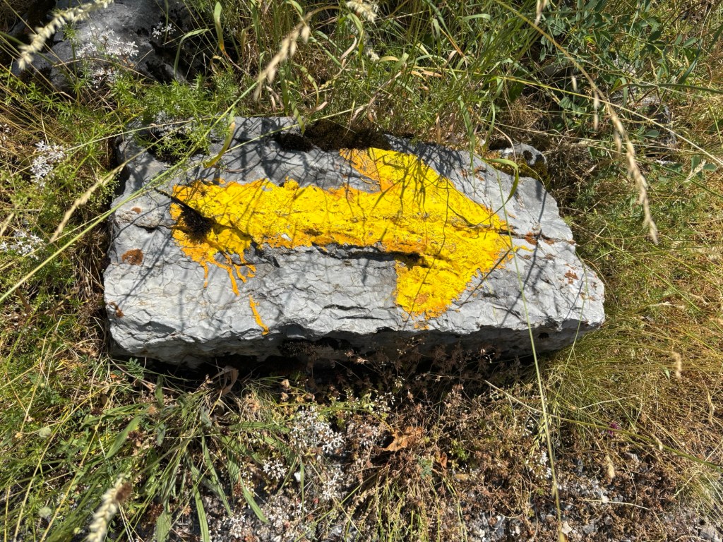
Tourists do come up here, though not in the same numbers that visit the more famous Inti Punku at Machu Picchu. I passed one group of five gringos coming back down the mountain, topped and tailed by a red-shirted Peruvian guide, and another solitary traveler, also accompanied by her local sherpa. They seemed surprised to see me heading up the sun gate alone. It is not a hard path to follow, though the road is dreadfully steep and cannot be rushed.

It took me nearly four hours to reach the summit, which is only partly explained by constantly stopping to look and listen out for the mountain’s wildlife en route. At times I was stopping after every ten steps – a reflection of the altitude rather than my fitness, I should like to think. I have climbed a similar height before with Skiddaw back home in the Lake District, but that hike starts at around 68m above sea level, not 2.792m.

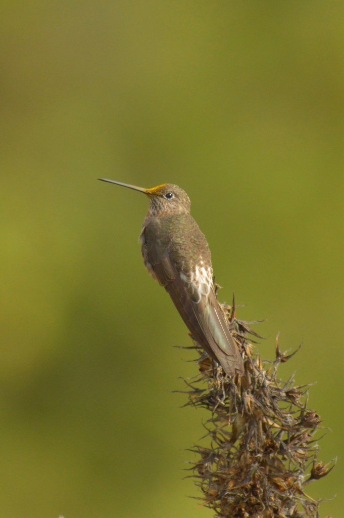
I clocked several new species during the ascent, including a mountain variety of cuy, but I was accompanied for most of the journey by hummingbirds. I counted several kinds: mostly sparkling violetears (they really are everywhere) but also lesser violetears, black-tailed trainbearers, white-bellied and giant hummingbirds, and – at the summit – an Andean hillstar. I have become quite used to the sight of them flitting about from branch to branch, holding themselves almost stationary in the air while feeding from flowers and launching themselves into the abyss of the valley on tiny, invisible wings. I shall miss them when I’m gone.


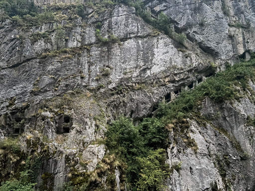
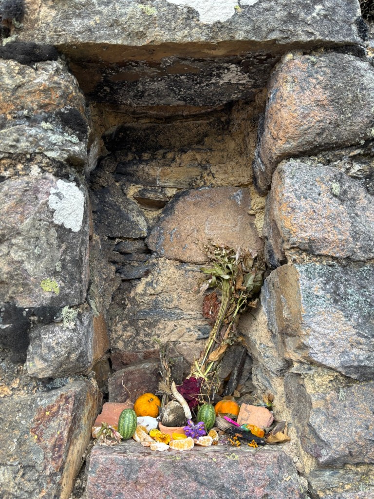
The time of the Inca is long gone, but it is clear that the locals continue to venerate the mountain and uphold its traditions. Niches in the wall of the Inti Punku contain offerings of coca leaves, dried but still pungent, while a more elaborate altar had been prepared in the largest window of the sun gate. The fruit was fresh – it can only have been laid out there less than a day ago. A bunch of wildflowers tied together with twine had been placed in one corner of the complex, facing the snowy peak of Wakaywillque.

I have heard stories of locals hiking up to these sacred places to make offerings to the old gods and the ancestors in other places, but I hadn’t seen it in practice until today. It only makes the Inti Punku a more magical place.


I think I saw a condor soaring high above the summit, but it was gone by the time I made it up there. There are other birds of prey in these mountains, but I’m fairly certain of what I saw. Nothing comes close to the size of the condor. The mountain caracaras, buzzard-eagles and Aplomado falcons that I encountered might as well be peons to that giant lord of the skies.

I gave myself nearly an hour at the summit, which I had entirely to myself. As the rain came down, I took shelter in the largest niche (which mirrors the gate itself) and had my lunch. I wondered how many others had come here over the many hundreds of years this sacred site has stood upon this ridge. What did they feel in this spot?


It took me a lot less time to go back down than it had to climb up: two hours and fifteen minutes compared to the four hour ascent. It helps that it is entirely downhill: there are no instances of climbing down and then back up again (which you certainly notice at this altitude).

I made it back to Ollantaytambo shortly after two and promptly fell asleep – I was quite spent after my exertions in the mountains. It is easily the most hiking I have done throughout the Peruvian adventure.

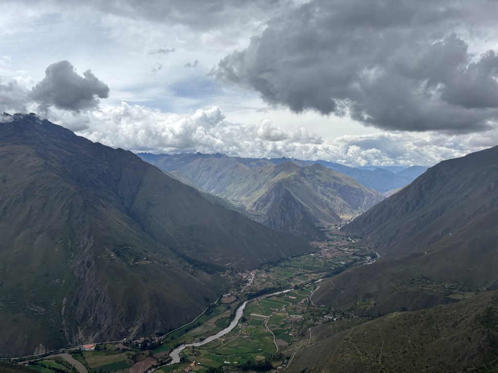
But it is done. I have sailed the Pacific in search of pelicans and penguins. I have walked the northernmost sands of the Atacama Desert. I have witnessed the majesty of the Andean condor at unbelievably close range and wandered the mirror lakes of the altiplano in search of South America’s three flamingos. I have beheld Cusco in its Inca glory, journeyed deep into the Peruvian Amazon and seen giant otters, macaws, tapirs, toucans and even uncontacted tribes with my own eyes. Now, as a final quest, I have climbed up to the Inti Punku and seen the entirety of the Sacred Valley under the deathless gaze of Wakaywillque.

I have achieved all that I set out to achieve. I can go home with my head held high.


There remains one last adventure before I arrive at my front door. I must return to Cusco, catch a flight back to Lima, and then journey to the legendary city that never sleeps – New York – where I have a few hours to explore one of the most famous cities on the planet before my final flight takes me back across the Atlantic to the familiar shores of England.

I have used every single day of my Easter holidays. By the time I make it home, I will have been on the road for twenty-three days. Work must resume mere hours after my return – but at least I go back to it knowing that I have not let even a single hour of my holidays go to waste.

I haven’t found Her. But then, I wasn’t looking for Her out here. I came here, quite selfishly, for me – and I could not be happier with how things have panned out.

I will ride this wave of adventure-fuelled optimism through the summer term with all of its ups and downs knowing that, whatever happens, I have rediscovered what it is to be alive once again, and to live for myself. I will treasure that to the end of my days. BB x

Camino III: Over the Frontier

Albergue Elías Valiña, Canfranc. 15.10.

I’ve made it over the border and into Spain! Canfranc is a beautifully quiet Aragonese mountain town, but it was one hell of a trek getting here from Borce, way over on the other side of the Pyrenees.


I set out a lot earlier than usual this morning, leaving Borce at 5.40am, a full hour before sunrise. I needed the extra hour to make it up the mountain, over the border and back down to Canfranc, the third village down from the pass on the Spanish side.

My intention to bypass the usual stop at Somport wasn’t as mad as it sounds. There were some pretty scathing reviews online about the Albergue, which I’d been tempted to write off as foreign ignorance, but there was also the matter of the considerable descent, which would have required another early start – not to mention the dangerous terrain underfoot should the weather turn foul. So, a full hour earlier than yesterday, I set out into the darkness.


It took me about an hour to reach Urdos, the last French commune before the frontier, and along the way I passed the formidable Fort Portalet, a 19th century fortress carved into the mountainside to guard the pass.

Arguably the most impressive thing about it was the network of bunkers and tunnels that seemed to burrow their way down the cliffside, presumably to allow the French garrison to snipe at any attempted invaders. I don’t even want to think about how they managed such a feat in 1842.


The sun came up just as I reached Urdos, or at least I think it did, because the Lescun valley was shrouded in a thick belt of cloud. The mountains must work like some kind of giant bowl, trapping the cold air inside. The result was a vast moisture net, turning all the vegetation within the valley floor into a living, breathing lake. For at least the first half of the morning, it was very beautiful to look at, and nothing further.


The Camino deviates from the main road a lot – perhaps a lot more than necessary – and one long deviation rides up the eastern slopes of the mountains above Urdos, where one of the tributaries of the Aspe river can be found. It also harboured my first non-Albergue stamp of the Camino Aragonés, in a small pilgrim station set out under a fir tree by a farmstead in the hamlet of Marrassaa. Some kind soul had put out some hot water, a selection of teas and sugars and a notebook with a stamp, along with a few walking sticks, should the Somport-bound pilgrim be lacking.


As it happens, as of twenty minutes before the stop, I wasn’t. Two hazel-wood sticks of near perfect size (one was a few inches shorter than the other) were lying in the road, the last remnant of what must have once been a fence, as they still had a very frayed but intact wire strung between them. Seeing an act of Providence – it would have been foolhardy to attempt the pass without them – I took them (and the wire) along with me, until they had smoothed enough in my hand to work the wire free.

When I was confronted by a far superior collection of sticks at Marrassaa, I was tempted to let the shorter one go, but found that I couldn’t separate the one from the other – it felt wrong, somehow. So I pressed on with my two fenceposts, which I dubbed the Palos de la Frontera – a play on the place I found them, and the Andalusian port from which Columbus set out for the Americas.

Boy, did I need them today.


The descent from the Urdos deviation was… costly. The sodden undergrowth all but drowned my feet, and as I was considering a change of socks, it provided a final challenge: a gauntlet of ankle-deep mud and nettles. I got as far as I could with both feet astride the ditch, until the gap became too wide and too dangerous to attempt. I could either endure the wrath of a tangle of nettles or face the mud. In the end, still feeling the sting of yesterday’s nettles, I swallowed my pride and sloshed straight through the mud. Vile.

Naturally, I washed my socks in the river at the foot of the valley, did my best to dry my sandals, and swapped in a pair of warm hiking socks. Thank goodness I had spares.


After a short stint along the road, the Camino climbed back up into the forest on the eastern side. I may have been cautious about leaving the road again – which wasn’t exactly heaving with traffic – but it was the fastest route to the top, so I stuck to it.

The cloud forest was mesmerisingly beautiful, especially as I hit the cloud level and seemed to be burrowing my way through the mist. The stretches of open grassland, however, were dreadful. Up here, in the thick of the clouds, the grass was even wetter than on the valley floor. I might as well have swum up the mountain. More treacherous by far, the path was so overgrown that it was perilously easy to miss the edge of the path and lose your footing – as I did at least once, very nearly tumbling down the mountainside. The sticks genuinely saved my neck.


It didn’t get any easier until I reached the road at the top of the mountain, where suddenly, as if by magic, the clouds disappeared entirely. It was easier to see why when I’d gone a little further, where the road turned to show me the huge belt of cloud trapped in the valley. Up here, above the clouds, it was as hot and sunny as any Spanish summer morning.


Somport itself was eerily quiet. I thought I’d earned myself a celebratory elevenses-lunch at the Albergue Aysa café, but a glance through the window showed no signs of life at all. The old border gate looked to be gathering dust, too, defunct since the arrival of the Schengen zone some forty years ago. No chance of an early lunch on the border, then – but I did say a prayer at the shrine of Mary, and I did appreciate the spectacular views down the Spanish side of the border.


In a heartbeat, I was suddenly in Spain. It’s amazing how quickly the world changes, national border or no. The lush vegetation of the French side was gone, replaced by a warm and dry boulder-strewn landscape, where the clustered forests gave way to spread-out stands of conifers. Crickets and cicadas replaced the chaffinches and blackbirds that had accompanied me up the other side, and all the hikers said buenas instead of bonjour.

Most striking of all were the carpets of English Iris, a Pyrenean flower of singular beauty that grew all over the place in the high meadows. They brought life to the place, which was much needed, as the ski station of Candanchú was little more than a ghost town. No shops, no traffic, no children in the park. All the ski lifts frozen in place where they ground to a halt several months ago. Just the sound of a door slamming shut in one of the apartment blocks I walked past. It was quite eerie.


It took me just shy of two hours to descend to Canfranc-Estación, the first living town on the Spanish side after Somport. Powered on by my fourth Nak’d bar (I brought eight out with me, but I was saving these for today’s trek), I made it down the mountain in reasonably good time. I changed my socks again just before descending, which was a very good idea – I wasn’t going to risk the blisters that might have ensued from a further three hours’ march in sodden feet. My sandals dried out quickly in the heat, which was a small blessing.

Canfranc-Estación is a curious affair, seemingly built around the enormous international railway station in 1928. The monstrous project paid minimal returns, and the station closed down in 1970 after a number of disasters included a fire in 1944 that destroyed almost all the homes in the town, driving the townsfolk to relocate to the village of Los Arañones further down the valley. There’s supposed to be plans afoot to get the station working again, but for now, the building serves as a rather grandiose hotel.


There are a few private albergues in Canfranc-Estación, but I had my heart set on the municipal in Canfranc Pueblo, which was still an hour’s walk away. It was already one o’clock, which is a silly time of day to be walking the Camino in summer, but I was adamant, so I decided to forgo the extremely tempting aromas coming from the asadores in town and press on.

Beyond the grand station, the Camino weaves its way down the mountainside through a series of shady forests and warm meadows. Quite a few locals had set up shop beside the pools created by the many rivers tumbling down into the valley, but I had a schedule to keep – I would have to be quick if I were to reach Canfranc in time for the 14.00 opening time of the municipal Albergue.

Fortunately, I had no need to check my phone to navigate anymore. The yellow trail markers have returned, almost as soon as I crossed the border. These flechas amarillas make it very hard to get lost on the Camino, making it surely one of the most welcoming of long-distance hikes in the world. I’ll tell you sometime about the man who came up with the idea. But that, I think, is enough for today.


The Norwegian couple who run this donativo albergue have offered to make both dinner and breakfast for the four of us sheltered here tonight. And what a donativo…! It’s one of the best set-ups I’ve seen in an albergue this side of Galicia. No wonder it was so highly praised online!

Time, I think, for a nap before dinner. At an estimated 1,300m of ascent and a further 700m of descent over 29km, I’ve earned it. BB x